Discover UK Aerial Mapping Expertise with uk aerial mapping solutions
- tribephotographyuk
- Feb 9
- 4 min read

When it comes to capturing detailed, accurate aerial data, the UK offers some of the best expertise in the field. Whether you need precise topographical maps, construction site monitoring, or event coverage from above, aerial mapping solutions in the UK have evolved to meet these demands with professionalism and cutting-edge technology. I want to share insights into how these services work, why they matter, and how you can benefit from them.
What Are UK Aerial Mapping Solutions?
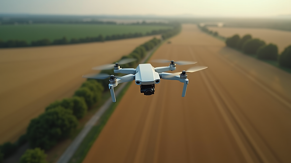
Aerial mapping solutions involve using drones or aircraft equipped with cameras and sensors to capture images and data from the sky. These images are then processed to create detailed maps, 3D models, or other visual representations of the land below. In the UK, these solutions are tailored to meet the needs of various industries, including construction, agriculture, real estate, and event management.
The technology behind aerial mapping has advanced rapidly. Today’s drones can fly at different altitudes, capture high-resolution images, and use GPS to ensure accuracy. The data collected is processed using specialised software to produce outputs like orthomosaic maps, digital elevation models, and volumetric analyses.
These solutions are not just about taking pictures from above. They provide actionable insights. For example, a construction company can monitor progress and detect issues early. Farmers can assess crop health and irrigation needs. Event organisers can plan layouts and security with a bird’s eye view.
Why Choose UK Aerial Mapping Solutions?
The UK aerial mapping industry stands out for several reasons:
Regulatory Compliance: UK providers operate under strict Civil Aviation Authority (CAA) regulations. This ensures safety and legal compliance, which is crucial for commercial drone operations.
Experienced Operators: Many UK companies employ pilots with extensive training and certifications. This expertise guarantees high-quality data collection and safe flight operations.
Advanced Technology: The UK market uses the latest drones and sensors, including LiDAR, multispectral cameras, and thermal imaging.
Customised Services: Providers tailor their solutions to specific client needs, whether it’s a small-scale survey or a large infrastructure project.
By choosing UK aerial mapping solutions, you gain access to reliable, precise, and legally compliant services that can save time and reduce costs.
How Aerial Mapping Services UK Can Transform Your Projects
Using aerial mapping services uk can bring tangible benefits to your projects. Here are some practical examples:
Construction and Infrastructure
Regular aerial surveys help track progress, identify potential hazards, and manage resources efficiently. For instance, a building site can be monitored weekly to ensure timelines are met and safety standards upheld.
Agriculture
Farmers can use aerial data to monitor crop health, detect pest infestations early, and optimise irrigation. This leads to better yields and reduced environmental impact.
Event Planning and Management
Large outdoor events benefit from aerial mapping by improving layout planning, crowd control, and emergency response strategies. Aerial views help organisers visualise the entire site and make informed decisions.
Environmental Monitoring
Conservationists and local authorities use aerial mapping to track changes in landscapes, monitor wildlife habitats, and assess the impact of natural disasters.
Real Estate and Land Development
Detailed maps and 3D models help developers and agents showcase properties, plan developments, and conduct site assessments.

What to Look for in a UK Aerial Mapping Provider
Choosing the right provider is key to getting the most from aerial mapping solutions. Here are some factors to consider:
Certification and Licensing
Ensure the company holds the necessary CAA permissions and that their pilots are fully qualified.
Experience and Portfolio
Look for providers with a proven track record in your industry. Ask for case studies or examples of past projects.
Technology and Equipment
Check what types of drones and sensors they use. Advanced equipment means better data quality.
Data Processing Capabilities
The provider should offer comprehensive data analysis and deliverables, such as maps, models, and reports.
Customer Support and Communication
Good providers keep you informed throughout the project and offer support after delivery.
Safety and Insurance
Confirm that the company follows strict safety protocols and has appropriate insurance coverage.
Getting Started with UK Aerial Mapping Solutions
If you’re ready to explore aerial mapping for your project, here are some steps to get started:
Define Your Objectives
What do you want to achieve? Clear goals help the provider tailor the service to your needs.
Contact a Specialist
Reach out to a reputable UK aerial mapping company. Discuss your project details and ask for a quote.
Plan the Survey
Work with the provider to schedule flights, considering weather and site access.
Review Data and Reports
Once the survey is complete, review the deliverables carefully. Ask questions if anything is unclear.
Apply Insights
Use the aerial data to make informed decisions, improve efficiency, and reduce risks.
By following these steps, you can harness the power of aerial mapping to enhance your projects and operations.
Embracing the Future of Aerial Mapping in the UK
The future of aerial mapping in the UK looks bright. Innovations like AI-powered data analysis, improved drone endurance, and integration with other technologies (such as GIS and BIM) are set to revolutionise the field. Providers are continuously improving their services to offer faster, more accurate, and more affordable solutions.
For businesses and individuals, this means better access to high-quality aerial data that can drive smarter decisions. Whether you are managing a construction site, planning an event, or monitoring the environment, UK aerial mapping solutions offer a reliable and efficient way to see the bigger picture.
I encourage you to explore these services and discover how they can add value to your work. With the right partner, aerial mapping can become a powerful tool in your toolkit.
If you want to learn more about professional drone services and how they can support your projects, consider reaching out to experts who specialise in safety-focused, high-quality aerial photography and mapping. The UK’s aerial mapping expertise is ready to help you take your projects to new heights.


Comments